Map showing the state of the forest in B.C.
Reports & Publications
Map of the state of the forest in B.C.
Map | 2025
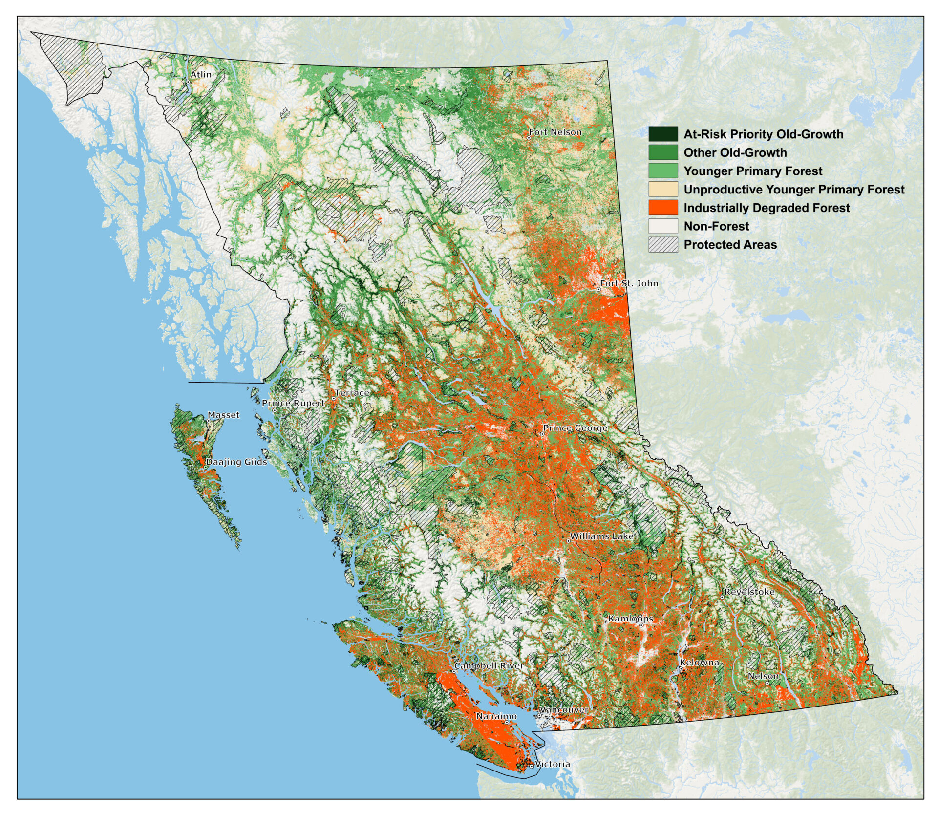
This map shows remaining old growth, including the most at-risk old growth recommended for logging deferral. Younger primary forests (i.e., not degraded but not old) include large areas of “unproductive” forests that support small trees. Industrially degraded forests include plantations, buffers around roads and other linear disturbances, and deforested and private land. Protected areas are shown by black hatching.
Industrial logging has targeted the most productive forests with the largest trees, so that a small fraction remains. Remaining big-treed old growth is included within the at-risk old growth; these forests are the highest priority for conservation.

Acknowledgements
Mapping by David Leversee. This map was created for the indpendent report “Closer to the brink: The state of forests in B.C. in 2025”.
You can help protect healthy ecosystems
Donate today. Together, we can build a brighter future.
Photo Credits: Mya Van Woudenberg